For those who did the first Cranky Penguin, the course will roughly comprise all of the 2013 event. There are some changes – the event start and finish has changed due to the different event centre. Also there are some new sections including something really surprising! Read on… The start will be from the Athletic Centre, to alleviate competitors parking and then having to commute to the starting point. There has been a new singletrack climb added, so we have taken out all of the bitumen road climb that was at the start of the race in 2013. There will be very little bitumen road on the return to Penguin. The final 7 kilometres will be predominantly singletrack with some fire road. The last 5KM or so is all downhill apart from a short climb up from the Environment Centre.
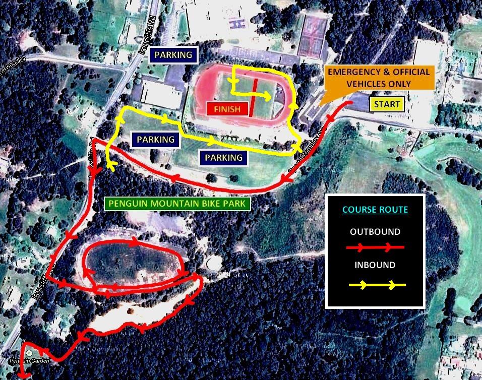
Here is an image of the Start – Finish area… Here is an image of the course map with checkpoints, in slightly lower resolution (click on this map for a larger image) – The above Course Map is available in a PDF file containing lots of detail. This map is available to download HERE. This file is 5Mb in size.
Below is the Competitor Information. You can also save this information in a PDF file HERE.
 Here is an image of the course map with checkpoints, in slightly lower resolution (click on this map for a larger image) –
 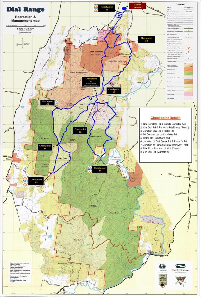 The above Course Map is available in a PDF file containing lots of detail. This map is available to download HERE. This file is 5Mb in size.